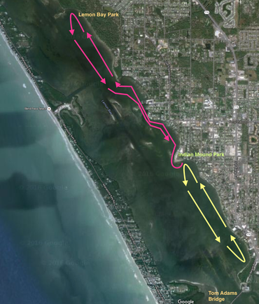
Typically we row at 6 AM through the week, and 7 AM on weekends. During the time of year when it's dark at 6 AM we usually row a well known 2 Kilometer course back and forth twice for a total of 8 KM with 3 rest periods between sets.

a google map of our usual 2 KM rowing course
The detail map below shows three shallow areas of concern at low tides
Google map showing the area just South of Indian Mound Park
detail map showing shallow areas where the skeg might drag at low tide. Click for larger view

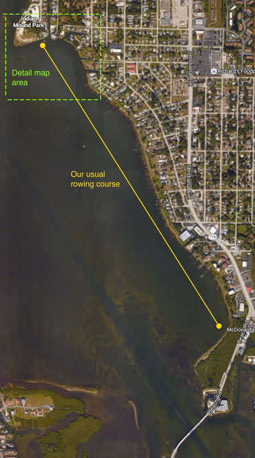
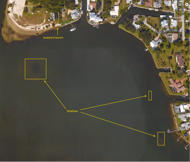
Our traffic pattern is close to shore when going North, either in our usual basin or when going to Lemon Bay Park. Stay offshore when rowing South.

A Google map capture with the route outlined. Traffic pattern designed to lessen collision risk between rowers. Close to land going North, away from shore going South. This shows Indian Mound in the center, our morning basin row in yellow, the route to Le
Traffic pattern designed to lessen collision risk between rowers. Close to land going North, away from shore going South. This shows Indian Mound in the center, our morning basin row in yellow, the route to Lemon Bay Park in red. Click to enlarge.